Subject: Midwest United States
Period: 1832 (dated)
Publication: History of the United States
Color: Black & White
Size:
14.5 x 9.5 inches
36.8 x 24.1 cm
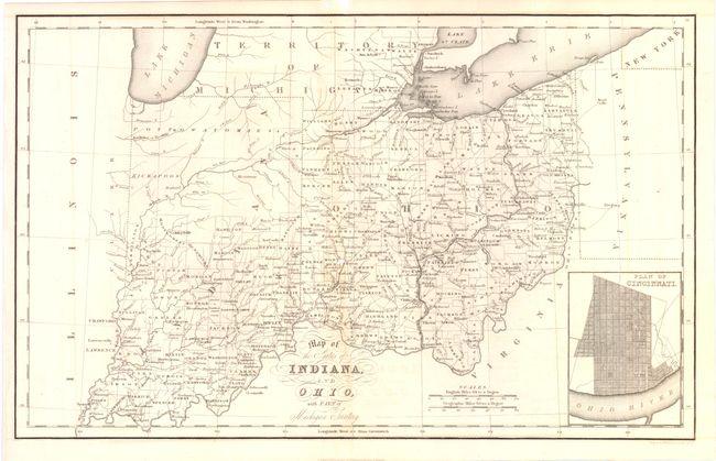
A. Map of the States of Indiana and Ohio, with Part of Michigan Territory . This attractive early 19th century map shows early county configurations, particularly in Indiana where the northern half is shown to be the territory of the Pottowatomies and Kickapoos. The lone exception is Allen County with Ft. Wayne, which provided a defense against the Indian frontier. In southern Michigan Territory only Washtenaw, Wayne, Lenawes and Monroe counties are shown to be organized. There is excellent detail throughout, including mountains, rivers, roads, lakes, towns, Indian tribes, and a host of other details. An inset plan of Cincinnati is at lower right. Condition: Small hole in the middle of the image, else good. Issued folded. (C+)
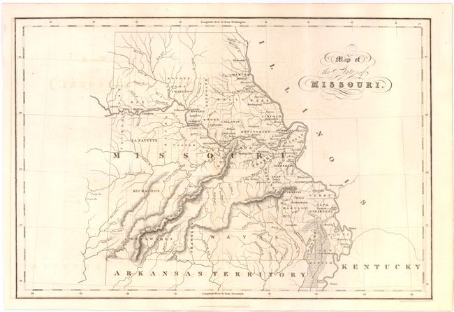
B. Map of the State of Missouri.. Attractive, early map of the state with settlement confined along the Mississippi and Missouri rivers and early county development. Many of the western counties exist in name only with no settlements shown and a massive Wayne County dominates the south. The Bounty Lands are shown in the north and several Indian nations are noted in the western part of the state. A fascinating map of the state issued shortly after statehood. Condition: Slight offsetting in the image, else very good. Issued folded. (B+)
References:
Condition:
See description.