Catalog Archive
Auction 139, Lot 179
An Excellent Revolutionary War Battle Map
"A Map of such Parts of Georgia and South Carolina as Tend to Illustrate the Progress and Operations of the British Army, &c.", Kitchin, Thomas
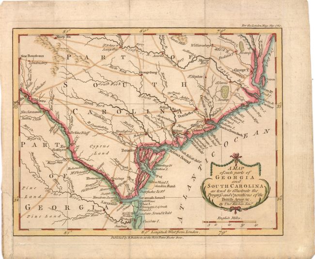
Subject: Georgia & South Carolina
Period: 1780 (dated)
Publication: London Magazine
Color: Hand Color
Size:
9.3 x 7.3 inches
23.6 x 18.5 cm
Download High Resolution Image
(or just click on image to launch the Zoom viewer)
(or just click on image to launch the Zoom viewer)