Subject: United States
Period: 1859 (dated)
Publication: H.R. Doc No.428, 36th Congress, 1st Session
Color: Black & White
Size:
14 x 9.5 inches
35.6 x 24.1 cm
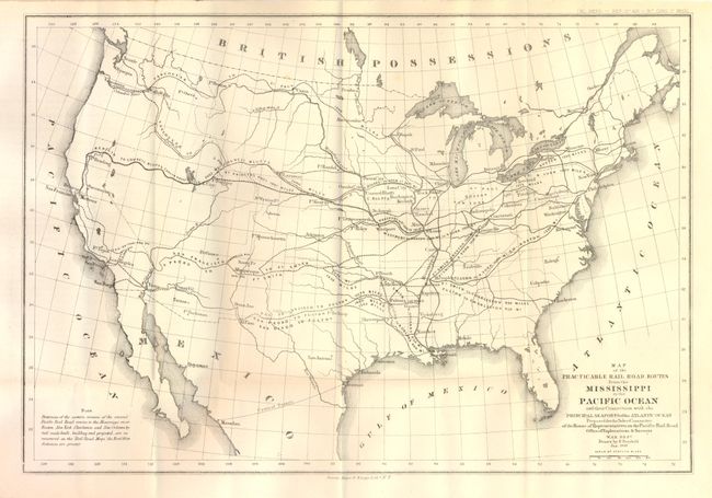
The title for this map continues "Prepared for the Select Committee of the House of Representatives on the Pacific Rail Road…Drawn by E. Freyhold Jan. 1859." The map folds into the original report "Pacific Railroad. To accompany Bill H.R. No. 646 . Mr. Curtis from the select committee on the Pacific Railroad, made the following Report." The map is described in the text as a miniature of the large Humphreys/Warren map, but it is quite different. In includes the entire United States with the connections and distances of the possible routes to the major east coast cities. The majority report called for the selection of the central route, a variation of which became the first trans-continental railroad. Arguing for an overland route, the report lists recent steamboat losses to underscore the advantages of the rail system. The map and accompanying report provide a fascinating picture of the history of American railroads.
References:
Condition: A