Subject: United States
Period: 1822 (circa)
Publication:
Color: Hand Color
Size:
17 x 10.5 inches
43.2 x 26.7 cm
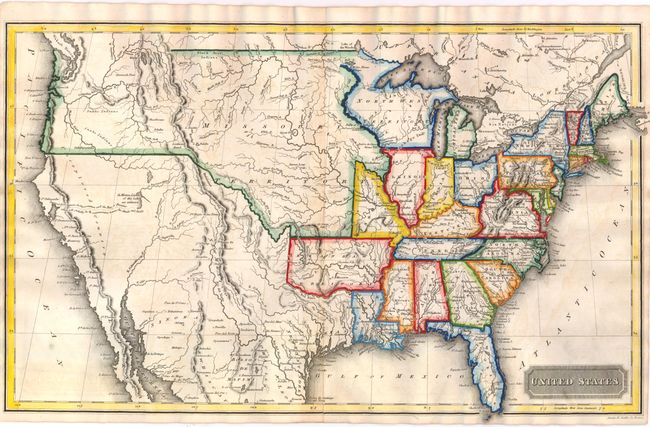
This uncommon map of the United States was engraved by Annin & Smith and published in Boston. Arkansas is in it's large configuration extending to Mexico, while Texas is named and is part of Mexico. The large North West Territory is bounded on the west by the Mississippi River and stretches to lakes Superior and Michigan. The central plains and Northwest are labeled Missouri Territory. The border between the United States and Canada stops in Montana, reflecting the disputed boundary between the U.S. and Britain in the Pacific Northwest. An unknown river bisects the unnamed Great Basin with a hopeful notation predicting it "will probably be the communication between the Atlantic and Pacific."
References:
Condition: B+
There is some faint offsetting and the lower centerfold has been reinforced with paper on verso.