Subject: Colonial United States and Canada - Great Lakes
Period: 1715 (circa)
Publication:
Color: Hand Color
Size:
11.8 x 8 inches
30 x 20.3 cm
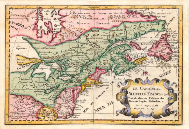
This is a reduced version of one of the most influential seventeenth century maps of the French and English colonies in North America. It concentrates on the region of greatest French interest. The entire Great Lakes basin and the St. Lawrence River are shown in great detail. The most important aspect of the map is the first appearance of L. Erie, ou du Chat as a recognizable lake on an atlas map. This delineation influenced the cartography of the region for more than 100 years and was not superceded until Delisle's "Carte du Canada" in 1703. The map is also an outstanding source for Indian tribal names and locations. Two names (Aouentsiouaeron and Attiouandarons) appear here for the first time. Lake Superior and Michigan (Lac du Puans) are left open-end to the west. This issue is from a re-engraved plate published by Joannes Ribbius and Simon de Vries.
References: Burden #575; Kershaw #135.
Condition: B+
Light toning along centerfold and a tiny tear adjacent to centerfold in <i>Nouv. Pays Bas.</i>