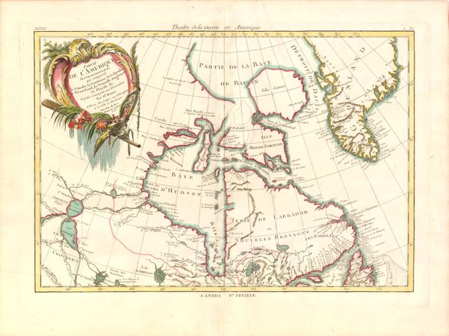
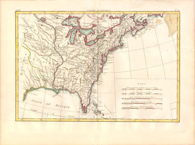
Subject: Colonial United States & Canada
Period: 1776 (dated)
Publication: Atlas Moderne
Color: Hand Color
Size:
17 x 12.5 inches
43.2 x 31.8 cm
Finely engraved pair of Revolutionary War maps covering the Eastern parts of North America. This map was first issued in 1771; here it is seen in the second state with the addition of Theatre de la Guerre en Amerique along the top of the first sheet, and the date of 1776. The first sheet contains the decorative title cartouche, and it covers eastern Canada and Greenland from the bottom of Hudson Bay, northward beyond the Arctic Circle to about 70 deg. N. Latitude. It includes an interesting depiction of a passage between Lake Winnipeg and Hudson Bay alluding to a possible passage to the Pacific. The second map covers French Louisiane and the British Colonies with their western boundary on the Mississippi River. Nice detail, particularly of the French forts and Indian villages.
References: Kershaw #474; McCorkle #771.2.
Condition: A
Watermarked paper with faint toning along centerfold.