Subject: United States & Canada
Period: 1598 (published)
Publication: La Geografia di Claudio Tolomeo Allessadrino…
Color: Black & White
Size:
9.7 x 7 inches
24.6 x 17.8 cm
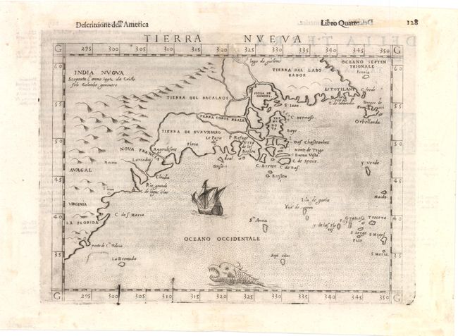
This important early map devoted to the East Coast of North America is based on Giacomo Gastaldi's map of 1548, which combined data from the Verrazano and Cartier voyages. The cartography is unchanged, with the exception of the depiction of the Hudson and St. Lawrence Rivers (unnamed), which are shown connected upriver, a notion he borrowed from Ramusio. Engraved on copper by Giulio and Livio Sanuto in the unmistakable Italian style. This is the last state with several additional place names, including Virginia, Nova Francia, Estotilant, and India Nuova, and a galleon and fierce sea monster adorning the sea. Italian text on verso.
References: Burden #30; Kershaw #20; McCorkle #561.2.
Condition: B+
Light printer's ink residue with two small tears near centerfold at top of map image that have been professionally repaired. Remnants of hinge tape on verso.