Subject: Eastern Canada
Period: 1851 (circa)
Publication:
Color: Hand Color
Size:
13 x 10 inches
33 x 25.4 cm
The maps from The Illustrated Atlas were first published in serial form to a target audience that led insular lives due to the expense and hardship of travel. All that changed as the progress of the nineteenth century brought swift and dramatic changes in public awareness of far away places. Tallis' maps no doubt played an important role in this dramatic awakening. These maps not only provided up-to-date geographical knowledge, but also used vignette views within the map's design to show the native people and their occupations, cities and points of interest. The maps hark back to a cartographic tradition from the Dutch mapmakers of the seventeenth century with finely engraved decorative borders. The maps were drawn and engraved by John Rapkin with views drawn and engraved by a number of prominent artists. The maps were issued as a complete volume from 1851 until about 1865. Some of the maps were also published in other history books published by Tallis including British Colonies and, without the vignettes, in geographical dictionaries and encyclopedias until about 1880.
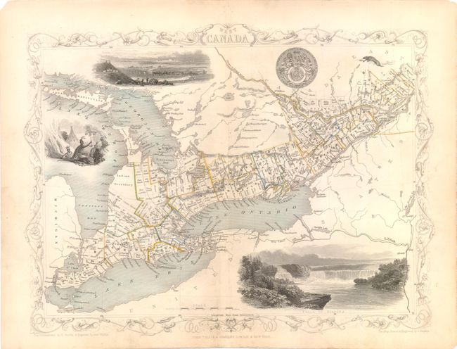
A fine steel-engraved map of the region of present-day Ontario surrounded in a decorative border. The map includes vignettes of Niagara Falls, an Indian encampment, a view of Kingston, the national seal, and a small river otter. The vignettes were drawn by H. Warren and engraved by Robert Wallis. The map itself was drawn and engraved by John Rapkin.
References:
Condition: B+
Original color with light soiling, a few small chips in blank margins, and short centerfold separations in top and bottom blank margins that have been closed on verso with Japanese tissue.