Subject: India, Pakistan and Afghanistan
Period: 1851 (circa)
Publication:
Color: Hand Color
Size:
10.5 x 13.5 inches
26.7 x 34.3 cm
The maps from The Illustrated Atlas were first published in serial form to a target audience that led insular lives due to the expense and hardship of travel. All that changed as the progress of the nineteenth century brought swift and dramatic changes in public awareness of far away places. Tallis' maps no doubt played an important role in this dramatic awakening. These maps not only provided up-to-date geographical knowledge, but also used vignette views within the map's design to show the native people and their occupations, cities and points of interest. The maps hark back to a cartographic tradition from the Dutch mapmakers of the seventeenth century with finely engraved decorative borders. The maps were drawn and engraved by John Rapkin with views drawn and engraved by a number of prominent artists. The maps were issued as a complete volume from 1851 until about 1865. Some of the maps were also published in other history books published by Tallis including British Colonies and, without the vignettes, in geographical dictionaries and encyclopedias until about 1880.
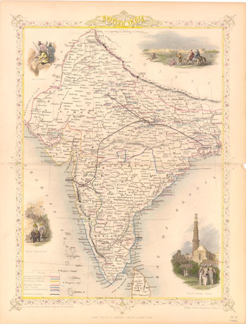
A. British India, from History of Britain. Decorative chart embellished with delicate border and four vignettes. Includes most of Sri Lanka, all of Punjab, and extends in the east to Hyperbad and to the delta of the Ganges in the east. Vignettes show Lahore with horsemen in the foreground, a band of Beloochees in ambush, a royal Indian procession with numerous elephants, and the Cootub Minar in Delhi. Legend identifies via hand colored lines the various presidencies of the country, military stations, civil stations, and the proposed railroads. The proposed rails run between Bombay, Delhi, Sholapoor, and Calcutta. Condition: Original outline color with faint toning along centerfold and a minute centerfold separation in right blank margin.
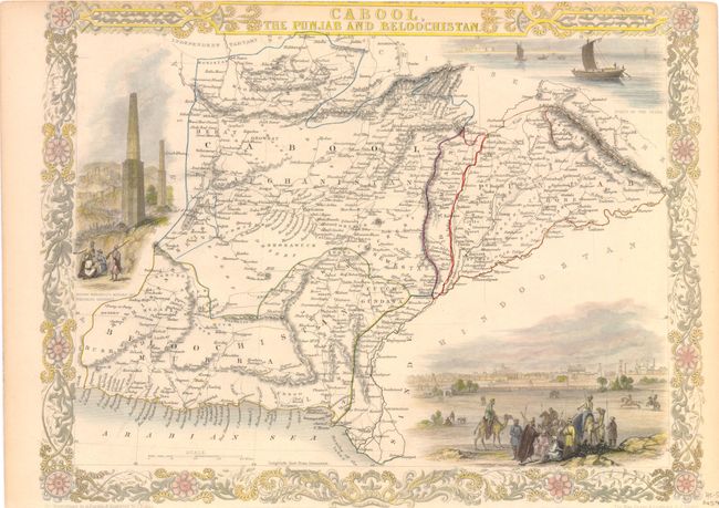
B. Cabool, the Punjab and Beloochistan, from Illustrated Atlas. Beautifully rendered map centered on Afghanistan and featuring vignette views with grand border and titling. Vignettes include "Boats on the Indus," "Sultan Mahmoud's Minars and Fortress, Ghuznee," and a large view of "Lahore" with many warriors and camels in the foreground. Condition: Original outline color, trimmed close to border at top and bottom, as issued. Light toning in blank margins.
References:
Condition: A
See description.