Subject: Surabaya & Pasuruan, Java
Period: 1725 (circa)
Publication: Oud en Nieuw Oost-Indiën
Color: Hand Color
Size:
7 x 12 inches
17.8 x 30.5 cm
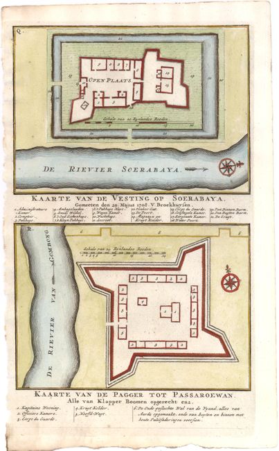
This sheet contains bird's-eye plans of two fortresses in northeastern Java, with keys identifying various buildings and features. At top is a map of the fortress in Surabaya, as depicted by G. v. Broekhuysen on March 20, 1708. The lower map is of the fortress in Pasuruan, which was surrounded by coconut trees and a "wall made of earth." The plans to these important ports were used by the Dutch East India Company when they overtook control of the cities from the Sultanate of Mataram in November 1743. Surabaya later became a major trading center under the Dutch colonial government. Valentyn was a prominent historian of the Dutch East India Company who is best known for Oud en Nieuw Oost Indien, his vast illustrated account of the Dutch trading empire in Asia. He twice traveled to the East Indies and served as Calvinist minister to Ambon between 1686 and 1694. In preparing this monumental work, he was given privileged access to the previously secret archives of the VOC, containing transcripts and copies of important earlier Dutch voyages.
References:
Condition: B+
Watermarked paper with a small wormhole in blank area of lower map, and another small one in key at bottom.