Catalog Archive
Auction 138, Lot 779

"L'Impero del Giapon Diviso in Sette Principali Parti…", Zatta, Antonio
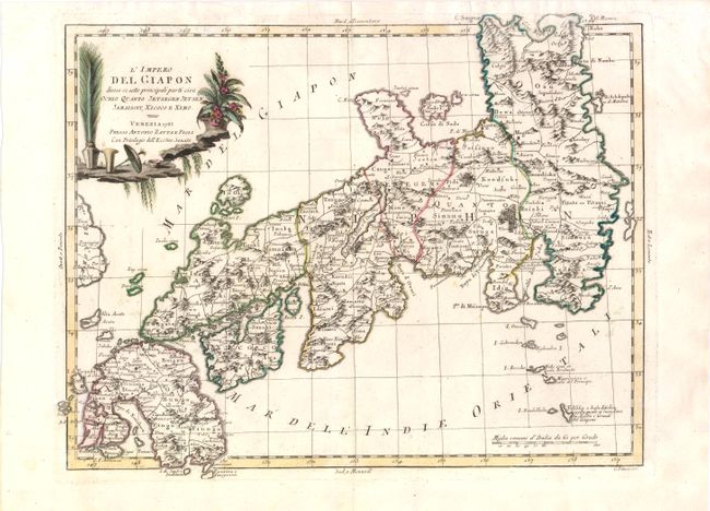
Subject: Japan

Period: 1785 (dated)

Publication: Atlante Novissimo…

Color: Hand Color

Size:
15.5 x 12 inches
39.4 x 30.5 cm
Download High Resolution Image
(or just click on image to launch the Zoom viewer)

This detailed map of Japan is divided into seven principal provinces and depicts numerous towns, mountains, and rivers. The map represents typical European cartography of the late 18th century, with a misshapen Honshu and an elongated Lago d'Otis (Lake Biwa). The map is adorned with a decorative title cartouche with potted plants and a parasol. Engraved by G. Pitteri.

References: Walter #OAG-119.

Condition: A

Original color with a few small, unobtrusive spots.

Estimate: $600 - $750

Sold for: $450

Closed on 12/7/2011

Archived