Subject: Hong Kong, Macao, China
Period: 1760 (circa)
Publication: Prevost's Histoire Generale des Voyages
Color: Black & White
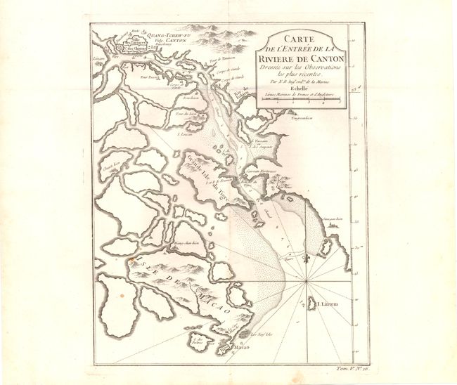
A. Carte de l'Entree de la Riviere de Canton Dressee sur les Observations les plus Recentes… , (8 x 10"). Copper engraved map of the mouth of the Canton River with the island of Macao and the future site of Hong Kong (Sinn-gan-hien). The fortified city of Canton is divided into Tartar and Chinese districts. Soundings and anchorages are shown and it is decorated with a cartouche, rhumb lines and fleur-de-lis. "Tom. V. No. 16" at lower right outside neatline. Condition - a few minor stains at lower left, else very good. Issued folding. (B+)
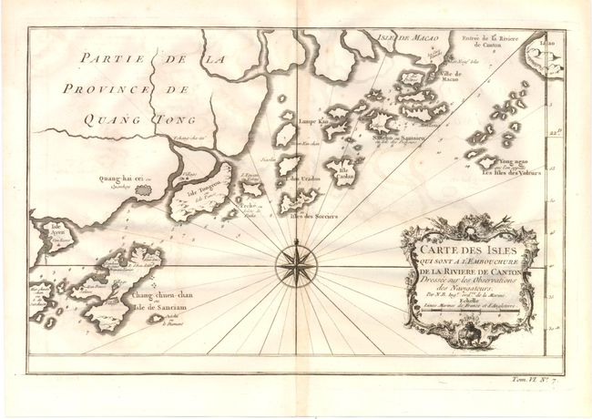
B. Carte des Isles qui sont A l'Embouchure de la Riviere de Canton..., (12.5 x 8.3"). This map shows nice detail of the islands off the coast of Southeastern China including Macao. There are numerous soundings noted with a large compass rose, fleur-de-lis, rhumb lines and decorative cartouche. "Tom. VI. No. 7" at lower right outside neatline. Condition - Light offsetting and minor centerfold toning, else very good. (B+)
References:
Condition:
See descriptions.