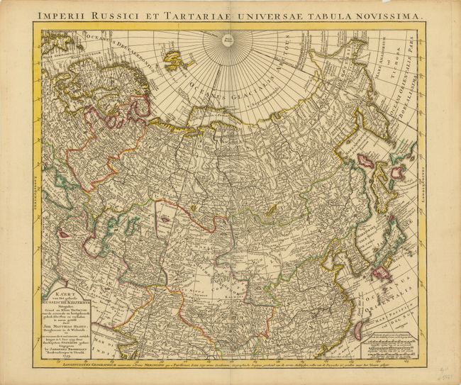
Subject: Northern Asia, Russian Empire
Period: 1743 (dated)
Publication:
Color: Hand Color
Size:
21.5 x 19.5 inches
54.6 x 49.5 cm
Finely engraved and detailed map by Johannes Broedelet that covers all of the region from the Baltic Sea across Siberia and south into China, including Korea, Japan and Formosa. The eastern coastline is taking shape with the formation of the Kamchatka peninsula. The Terra Eso Yedso is still a bit misshapen and the region formerly labeled Companies Land is named Terra Societatis Batavicae. In the north, Novaya Zemlya is connected to the mainland. This is a Dutch edition of the more common Homann Heirs map. The Dutch title cartouche gives credit to Johan Matthias Hasius and Captain Martin Petrovich Shpanberg, a Danish-born naval lieutenant who took part in Bering's expeditions to Kamchatka.
References:
Condition: A
Original outline color with a short centerfold separation that just enters map border at bottom that has been closed on verso with old paper.