Subject: Southwestern Germany
Period: 1680 (circa)
Publication:
Color: Hand Color
Size:
14.7 x 11.5 inches
37.3 x 29.2 cm
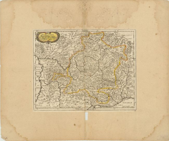
This detailed map of Franconia in southwestern Germany is comprised of the northern parts of the modern state of Bavaria, a small part of southern Thuringia, and a region in northeastern Baden-Wurttemberg. The Rhine, Danube and Main Rivers wind through the region with their extensive river systems. The cities of Frankfurt, Mannheim, Nurenberg, Stuttgart, and Ingolstadt are depicted, along with numerous other towns. The map is adorned with a decorative title cartouche.
References:
Condition: B
Trimmed close to neatlines and mounted on backing paper, with light toning and a small hole along centerfold towards bottom. The backing paper has several damp stains, and a hole and a few tears just below map.