Subject: Low Countries
Period: 1704 (circa)
Publication:
Color: Hand Color
Size:
21.3 x 18.3 inches
54.1 x 46.5 cm
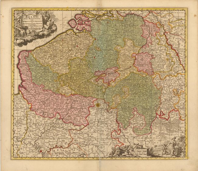
This attractive and finely engraved map covers Belgium, Flanders, Luxemburg and parts of France and Holland. Densely filled with towns, villages, churches and many rivers, and decorated with two figurative cartouches and a compass rose. The title cartouche is on a drape held by two putti, with the goddess Athena at left with her owl symbolizing wisdom and her shield with Medusa's head symbolizing war. The scales of miles cartouche is embellished with a river god pouring water from a vessel to symbolize the waters of the region, earth-goddess Gaia, and Hermes representing harvest and trade. An index to the map in both French and Dutch is on verso.
References:
Condition: B+
Original color with a few minute worm holes, light toning along centerfold at top, and marginal soiling. A centerfold separation that enters 9" into map at bottom has been closed on verso with old paper.