Subject: Netherlands
Period: 1680 (circa)
Publication: Atlas
Color: Hand Color
Size:
19.5 x 15 inches
49.5 x 38.1 cm
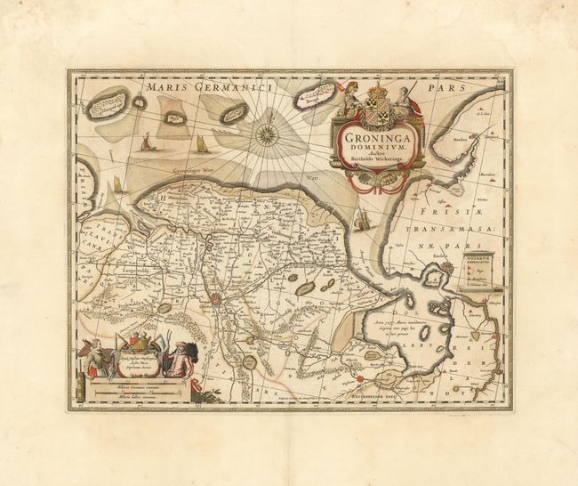
This map of the province of Groningen and the Ems estuary was originally drawn by Barthold Wicheringe. It shows Gronningen, Netherlands on the left and Emden, Germany on the right. The map shows the Dollert (Dollart), a large basin in the estuary, with a note about the 1277 flooding of the villages when it formed. There is much detail shown on the map, including roads, dikes, fortified cities and pictorial topography. Two splendid cartouches enliven the map; the title cartouche is attended by a classical warrior and a depiction of Justice, and the scale of miles is surrounded by figures relating to agricultural. The plate was originally engraved by Jan Jansson. After his death it was inherited by his son-in-law, known as Jansson-Waesberg, who published it in conjunction with Moses Pitt and Stephan Swart.
References:
Condition: B+
Good impression with very wide margins and original color heightened with gold leaf. The color is slightly faded and oxidized and there is a minor crack along the River Ems that is reinforced on verso with light tissue. Overall the paper is sound and supple.