Subject: Ireland
Period: 1639 (published)
Publication:
Color: Hand Color
Size:
15 x 13.5 inches
38.1 x 34.3 cm
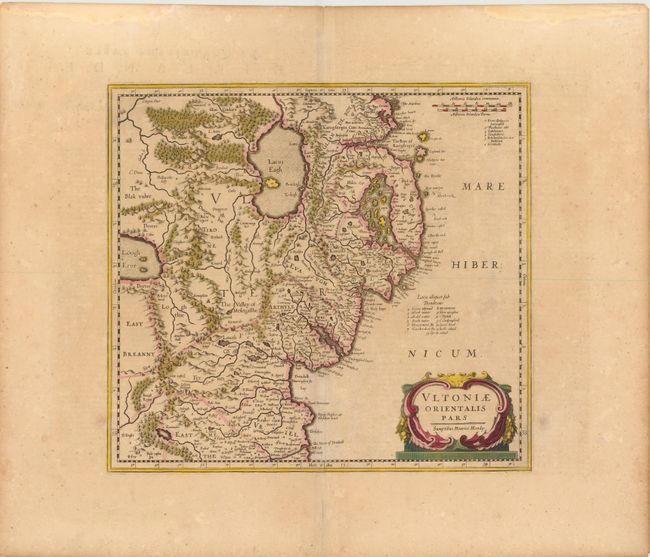
This is the second sate of Mercator’s map covering Down and Antrim counties in Northern Ireland. This was one of five Irish maps Gerard Mercator designed for the second part of his Atlas. It is beautifully engraved with strong topographical features in the interior. After 1636, the plate was altered to remove the shading in the sea, add a distance scale at upper right, and redesign the title cartouche, which contains Henricus Hondius’ imprint, Sumptibus Henrici Hondy. French text on verso.
References: Law, p. 21.
Condition: B+
Original color and wide margins with light toning and a few light spots. A centerfold separation in bottom blank margin has been closed on verso with Japanese tissue. There are light damp stains in upper blank margin, far from map image.