Subject: Peru
Period: 1633 (circa)
Publication:
Color: Hand Color
Size:
14 x 11 inches
35.6 x 27.9 cm
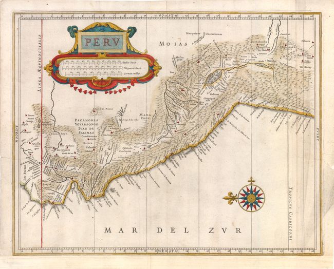
This great map is a foundation map for later Dutch maps of Peru. The map is the work of Hessel Gerritsz, one of the truly important Dutch cartographers of the 17th century. Most of his work was only done in manuscript and these maps, published by De Laet, are the only Gerritsz maps available to the collector today. The map vividly depicts the mountainous region and the large Titicaca lake, which is dotted with islands. A splendid strapwork title cartouche and compass rose adorn the map.
References:
Condition: B+
Watermarked paper with light surface soil and a crease along right side, now pressed. There are two minute worm holes only visible when held to bright light. Remargined at bottom and expert repairs of a couple tiny marginal tears.