Subject: Peru
Period: 1605 (published)
Publication: Histoire Universelle des Indes…
Color: Hand Color
Size:
11.3 x 9 inches
28.7 x 22.9 cm
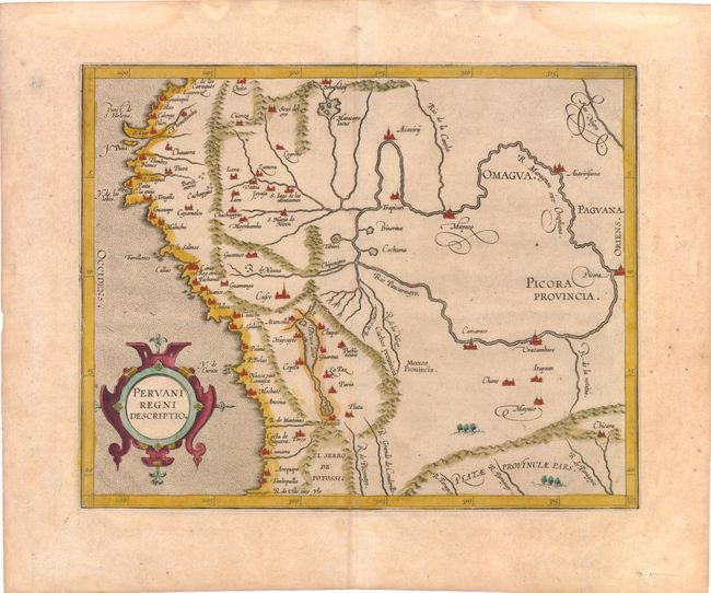
This important early map of Peru is finely engraved with numerous cities located throughout. Lake Titicaca is elongated and joined with Aulaga Lake. The map is embellished with a large strapwork title cartouche and a stipple engraved sea. This is the second state of the map, with the date removed from the title cartouche. The first state appeared in Wytfliet's Descriptionis Ptolemaicae Augmentum… in 1597, which is considered the earliest atlas to focus on the Americas. This edition is from the first French translation of Wytfliet's important atlas.
References: Nordenskiold #309-6.
Condition: B+
Lightly toned, watermarked paper. There are faint damp stains and a small hole in blank margins, far from map image.