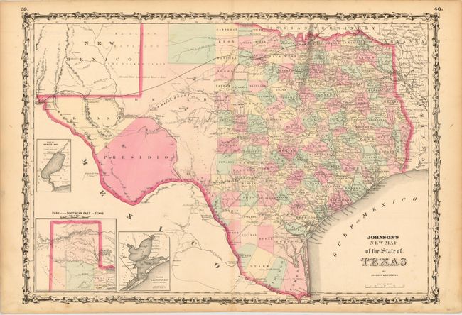
Subject: Texas
Period: 1861 (published)
Publication: Illustrated Family Atlas of the World
Color: Hand Color
Size:
24 x 17 inches
61 x 43.2 cm
The first edition of this handsome map, with county development mostly in eastern Texas and only the three large counties of El Paso, Presidio, and Bexar in the west. The panhandle, noted as the Staked Plain (Elevated Table Land, without Wood or Water), includes a large section that is unorganized. There are numerous wagon roads, a few completed railroads, and the US Mail Route traced on the chart. Insets include a Plan of Sabine Lake, Plan of the Northern part of Texas, and Plan of Galveston Bay. Surrounded by Johnson's early strapwork border. Blank on verso.
References: Day #1416.
Condition: B+
Original color with light toning and a few faint stains. There is one insignificant short tear on the centerfold that is confined to the blank margin.