Subject: North Carolina, South Carolina
Period: 1863 (published)
Publication:
Color: Hand Color
Size:
24 x 17.3 inches
61 x 43.9 cm
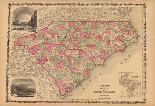
A nice example of this map from the last year it was produced as a steel engraving. There is detail throughout including county boundaries, cities, roads, railroads, mountains, rivers and coastal details. The map has a large inset: Plan of Charleston, Vicinity and Harbor, and a smaller inset of Fort Sumter. Inset shows the Harbor, Cooper and Wando Rivers, and the city in good detail. The map also features two vignettes: Chimney Rocks and French Broad River, and Table Mountain. Surrounded by an elegant strapwork border.
References:
Condition: A
Even-age toning with a tiny portion of the lower left corner of blank margin missing.