Catalog Archive
Auction 138, Lot 308

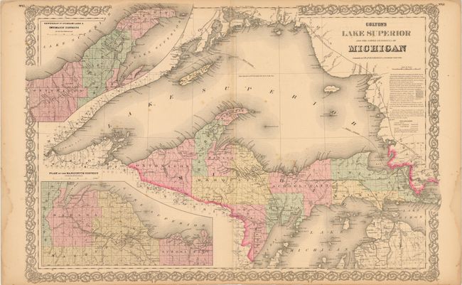
"Colton's Lake Superior and the Upper Peninsula of Michigan", Colton, Joseph Hutchins

Subject: Michigan

Period: 1868 (dated)

Publication:

Color: Hand Color

Size:
25.5 x 17 inches
64.8 x 43.2 cm
Download High Resolution Image
(or just click on image to launch the Zoom viewer)

This is a lovely 19th century map of the Upper Peninsula of Michigan. County surveys have been completed and the coastline and islands are precisely depicted. Included are inset maps of the "Plan of the Marquette District" and "Keweenaw Pt., Portage Lake & Ontomagon Districts." The lakes and rivers of adjacent northern Wisconsin, Canada are included. This edition features a lovely scroll border.

References:

Condition: B

There is some damp staining in the left and right margin and some scattered spots in the image. The lower centerfold has a clean separation that extends three inches into the image.

Estimate: $100 - $140

Sold for: $50

Closed on 12/7/2011

Archived