Subject: Chicago, Illinois
Period: 1894 (circa)
Publication:
Color: Hand Color
Size:
23.5 x 35.8 inches
59.7 x 90.9 cm
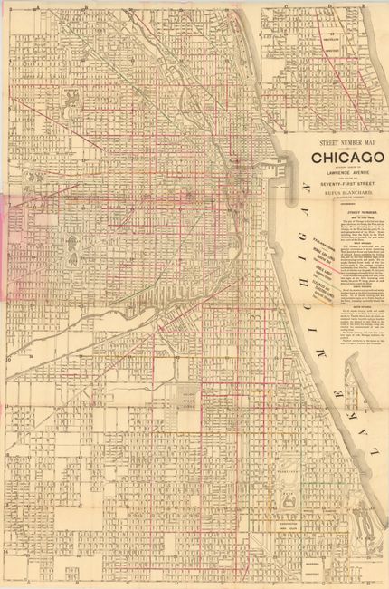
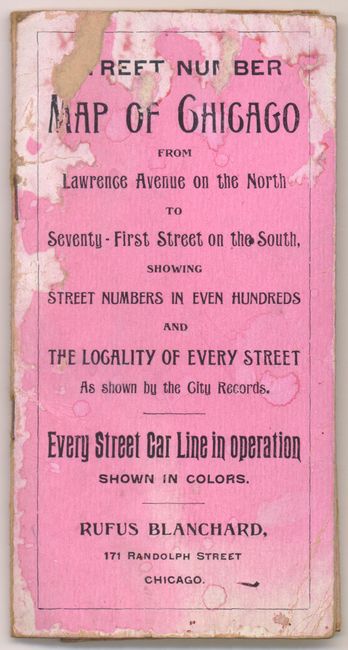
This detailed street map of Chicago on banknote paper runs "North to Lawrence Avenue and South to Seventy-First Street." The most prominent part of this map is the use of outline color to highlight street car routes. Pink outline color indicates horse car routes, green represents cable lines and orange depicts elevated and electric lines. Attached to pink paper wrappers with a 9 page street index.
References:
Condition: B
There are a couple of tiny splits at fold intersections and a few pencil marks in the image near Lake Park. There is some light staining where the map is glued to its wrappers, which are worn and damp stained.