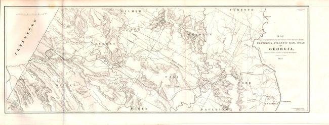
Subject: Georgia
Period: 1837 (dated)
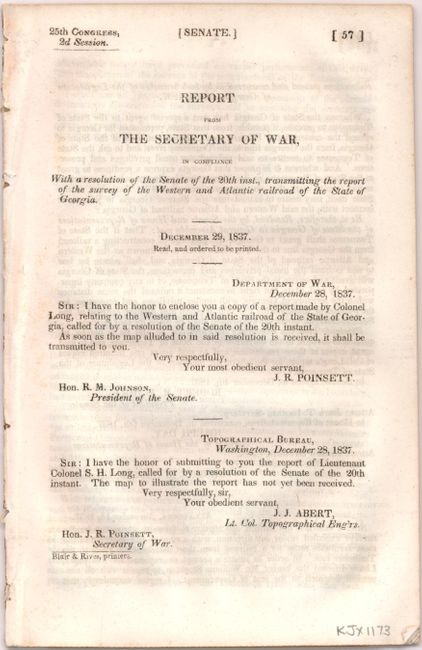
Publication: Sen Doc. No. 57, 25th Congress, 2nd Session
Color: Black & White
Size:
21.3 x 7.5 inches
54.1 x 19.1 cm
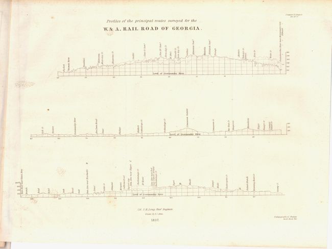
According to Modelski this is the earliest printed railroad map residing in the collection of the Library of Congress that was based on government surveys. The map was surveyed and drawn by M. M. Stansbury of the U. S. Topological Bureau. When the route was completed in 1850, it ran 138 miles between today's Atlanta and Chattanooga. Its strategic location made it a key supply route for the Confederacy and was the track for the famous 'Andrew's Raid' in 1862 when Union soldiers captured the locomotive General. A most desirable and early railroad map. Accompanying the map is a 40 pp. report by Col. Stephen H. Long.
References: Modelski Railroads First 100 Years No. 6 (illustrated); Modelski #613; Claussen & Friis # 181.
Condition: A
There are a few minor spots confined to the margins, else fine. Issued folding.