Catalog Archive
Auction 138, Lot 288

"Plan de Pansacola",

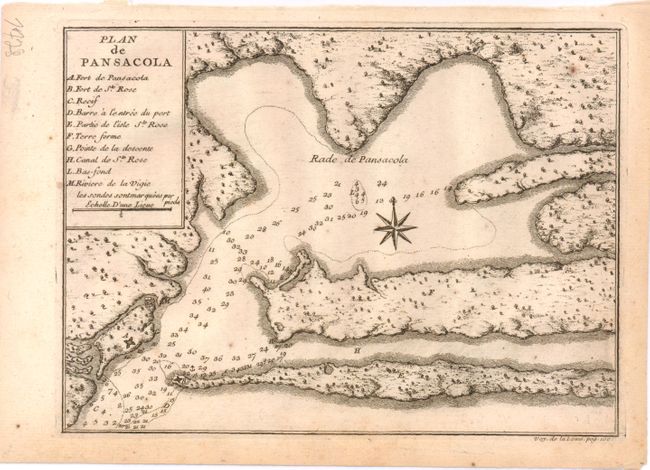
Subject: Pensacola, Florida

Period: 1728 (published)

Publication: Voyage de la Louisiane

Color: Black & White

Size:
8.3 x 6 inches
21.1 x 15.2 cm
Download High Resolution Image
(or just click on image to launch the Zoom viewer)

A rare, early chart of Pensacola Harbor, showing the locations of forts St. Charles and St. Rose, as well as soundings and anchorages. This map was included in Antoine Laval's Voyage de la Louisiane, the report by the scientist of a 1720 expedition to the Florida and Louisiana coasts, commanded by Valette-Laudun.

References: Howes #L147.

Condition: B+

Light toning primarily confined to blank margins.

Estimate: $400 - $500

Sold for: $300

Closed on 12/7/2011

Archived