Subject: Black Hills, South Dakota
Period: 1875-76 (dated)
Publication:
Color: Black & White
Size:
18 x 16 inches
45.7 x 40.6 cm
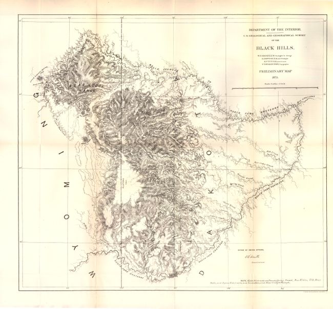
This map shows the Black Hills area which is flanked by the North and South Forks of the Cheyenne River. There is incredible detail of relief through hachure and many elevation points are noted. There is a note at bottom left that identifies gold districts including Bear Lodge Range and the Elk, Box Elder and Spring creeks to name a few.
Included with the map is a 71 pp. report by Walter Jenney that describes the recently-discovered gold occurrences and early mining operations in the area. This report corroborated an earlier account of gold by G.A. Custer in 1874. Jenney's map and report were released in 1876 and caused a massive rush of prospectors and immigrants to the region, which was considered sacred land by the Sioux. This influx of people led to the Great Sioux War of 1876-77 and the demise of Custer at Little Bighorn. A scarce and important report.
References: Wheat #1264.
Condition: A
Condition code is for the map. There is just a hint of toning along the folds, else fine. The report is disbound and the pages have a hint of toning.