Catalog Archive
Auction 138, Lot 273

"Geological Map of the Country between San Diego and the Colorado River…", Blake, W. P.

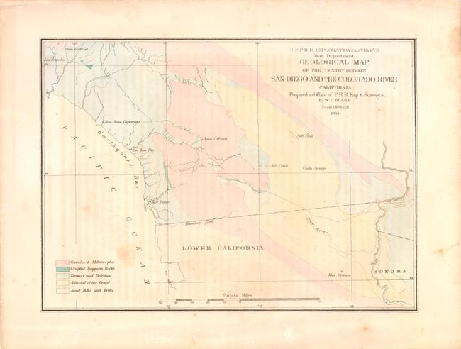
Subject: Southern California

Period: 1855 (dated)

Publication:

Color: Hand Color

Size:
9.3 x 6.8 inches
23.6 x 17.3 cm
Download High Resolution Image
(or just click on image to launch the Zoom viewer)

This map of southern California defines five geological units named in the legend via hand coloring. Showing the region along the border with Mexico, the map locates San Diego, San Luis Rey, San Juan Capistrano, Los Angeles, San Gabriel, and Agua Caliente. The map also names a Salt Pond, Salt Creek, Soda Springs and a Mud Volcano in Mexico.

References:

Condition: B

There is some faint offsetting in the image and a few small stains, else good.

Estimate: $100 - $130

Sold for: $65

Closed on 12/7/2011

Archived