Subject: Southwestern United States, Arizona, New Mexico
Period: 1874 (dated)
Publication:
Color: Hand Color
Size:
14 x 11.3 inches
35.6 x 28.7 cm
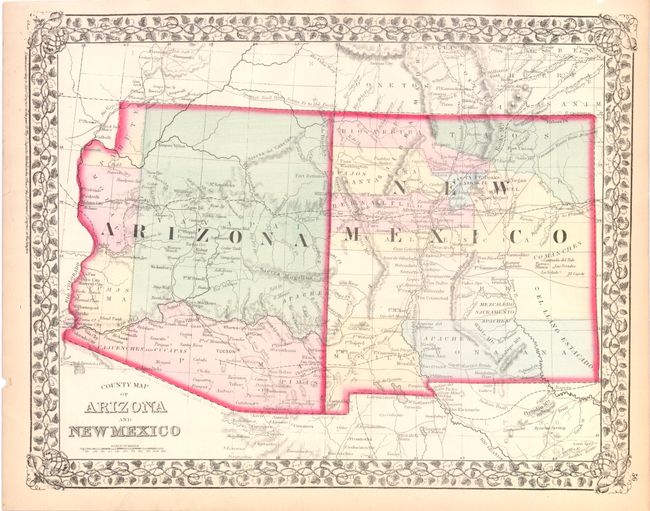
Very attractive map with early county configurations, including the short-lived Pahute County in northwestern Arizona, one of the only maps to show this 'county.' The county was a political artifact resulting from Arizona's loss of its northwestern corner to Nevada. The map shows the first four counties of Arizona: Mohave, Yuma, Yavapai, and Pima. New Mexico has its "strip" counties. The maps shows numerous Indian tribes and villages, military forts and outposts, the Spanish Trail, copper and gold mines, and the tracks of many explorers. It is enclosed in a decorative grapevine border.
References:
Condition: A
Original color with a few small edge tears, else fine.