Subject: Southwestern United States
Period: 1850 (published)
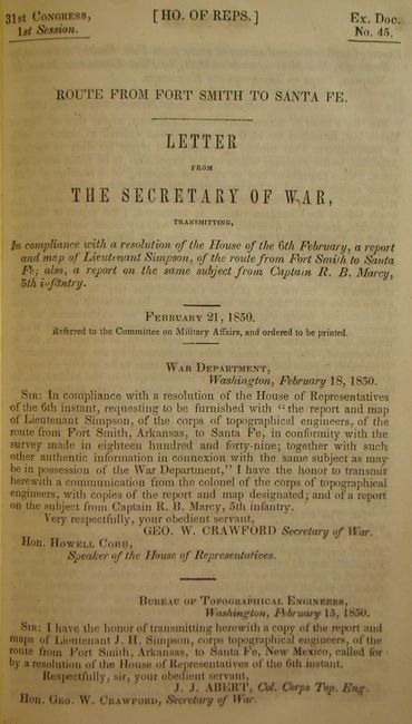
Publication: 31 Cong., 1st Sess, House Ex. Doc No. 45
Color: Black & White
Size:
27.5 x 14.5 inches
69.9 x 36.8 cm
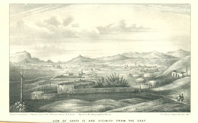
This important map is bound in the original and complete report "Route from Fort Smith to Santa Fe. Letter from the Secretary of War" by Capt. R.B. Marcy, 5th U.S. Infantry, made by order of Bvt. Brig. Gen. M. Arbuckle. On the first page the report is forwarded by J.J. Abert, Col. Corps Top. Eng. to Hon. Geo. W. Crawford, Secretary of War and finally to the Hon. Howell Cobb, Speaker of the House of Representatives. This excellent topographical map delineates, for the first time, the region along the Red and Canadian Rivers. It shows two major roads from Fort Smith to Santa Fe, plus several other routes and Indian trails. The map also notes various tribal lands, topography and hydrology as well as the location of daily campsites. It is filled with interesting details and notations including the Apache Trail and Comanche Trail - "Said to be a good route for wagons, with water daily." It includes a very early depiction of Dallas located along the Trinity River. Wheat says "Marcy's was the first comprehensive map of this area…" The report is recently rebound in green cloth with new end papers, 89pp, large folding map, and two plates by R. H. Kern, including "View of Santa Fe and Vicinity from the East."
References: Howes S500, [map] Wheat TMW #681.
Condition: B
The map is cleanly split along one fold, loose from book, otherwise very good. The plates are fine. The text contents are also fine and the binding is new and flawless.