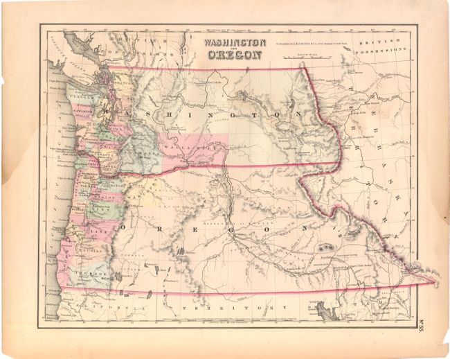
Subject: Northwestern United States, Washington, Oregon
Period: 1853 (dated)
Publication: General Atlas
Color: Hand Color
Size:
14.8 x 11.8 inches
37.6 x 30 cm
A great map of the Pacific Northwest showing both territories extending to the Continental Divide and incorporating the region that would become Idaho. Of specific interest is the notation of all the major exploration routes, wagon trails and the proposed routes for the transcontinental railway as explored by Gov. Stevens. A few organized counties are confined to a narrow band along the coast and Wascopen, Skamania and Walla Walla are the only counties east of the Cascade Range. Dated 1853 but published circa 1857.
References:
Condition: B+
There is some damp staining primarily in the left and right margins and a few insignificant edge tears that have been repaired with archival tape on verso.