Subject: Northwestern United States
Period: 1865 (dated)
Publication:
Color: Hand Color
Size:
23.5 x 17 inches
59.7 x 43.2 cm
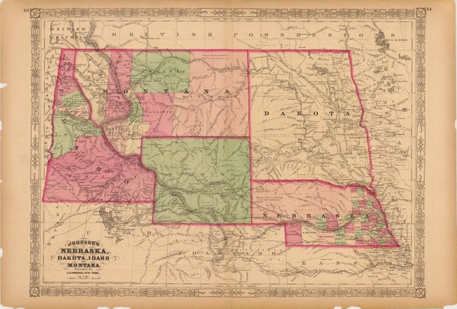
This colorful double-page map shows a very early rendering of Wyoming Territory, organized in 1868. Idaho is shown taking up the present-day Wyoming region south of Jackson Hole. It correctly shows Montana which, along with Wyoming, was previously contained in a large Idaho territory. Dakota Territory, from which Wyoming was formed, remains undivided. There is excellent detail throughout with scores of place names, roads, watershed, topography, the Emigrant Road, forts, springs, and lots more. The map retains the 1865 copyright date, but was published circa 1868.
References:
Condition: B
There is a clean lower centerfold separation that extends five-inches into the image and some light offsetting. There are a few chips and edge tears in the blank margins.