Catalog Archive
Auction 138, Lot 246

"Map of the Cordilleran Region Showing the Distribution of Woods and Forests", U.S. Geological Survey (USGS)

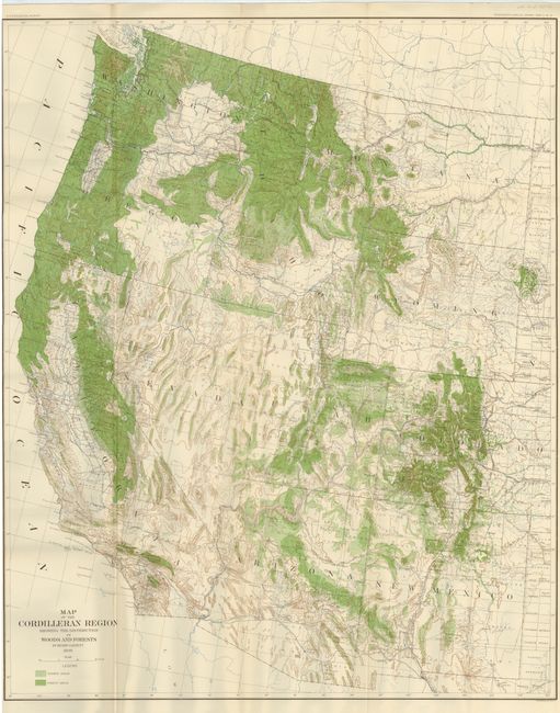
Subject: Western United States

Period: 1898 (dated)

Publication:

Color: Printed Color

Size:
29.5 x 36.3 inches
74.9 x 92.2 cm
Download High Resolution Image
(or just click on image to launch the Zoom viewer)

This is a colorful and detailed map of the entire western United States covering the region from New Mexico to California north to Montana and Washington. Cordillera refers to a system of mountains, and in this case features the Rocky Mountains, Sierra Nevada and Cascade ranges. The map is shaded in light and dark green representing wooded and forest areas. There is also extensive detail of relief, rivers and county boundaries.

References:

Condition: A

Folding and trimmed to neatline at left, as issued.

Estimate: $100 - $130

Sold for: $65

Closed on 12/7/2011

Archived