Subject: Western United States
Period: 1864 (circa)
Publication: Octavo Atlas of the World
Color: Hand Color
Size:
8.3 x 10.5 inches
21.1 x 26.7 cm
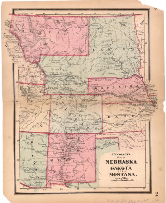
This scarce map covers a larger region than the title suggests, stretching from Arizona and New Mexico through the Great Plains with Montana, Idaho and a huge Dakota Territory. Wyoming has not yet been formed and is part of Dakota territory. There is good detail on the map including locations of numerous forts and routes such as the Pony Express and U.S. Mail route. The gold region south of Denver, Colorado is noted as well as the Salmon and Nez Perces gold mines in Idaho and the silver mines in Arizona. The map is particularly interesting for the number of forts shown that illustrate the U.S. Army’s efforts to control the Plains Indians. Wheat credits this with being the first atlas map of Montana, which was split out of the large Idaho Territory in May, 1864. The boundary between the two territories is shown along the Bitterroot Mountains rather than the Continental Divide.
References: Wheat (TMW), #1100.
Condition: B
There are some pencil notations on the map but they are not very distracting. There are also a few edge tears that are confined to the blank margins along with a few small stains.