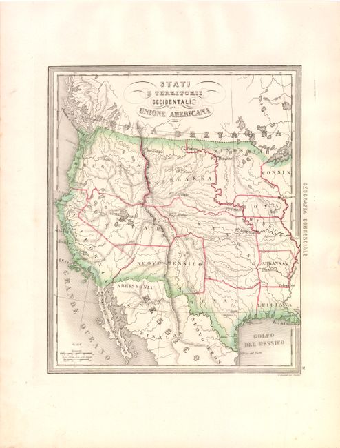
Subject: Western United States
Period: 1850 (circa)
Publication: Corso di Geografia Commerciale
Color: Hand Color
Size:
10.8 x 13.3 inches
27.4 x 33.8 cm
This is a very scarce Italian map illustrating the western part of the United States. The map shows the region with a pre-Gadsden Purchase border with Mexico. It covers the area from the Mississippi River to the west coast. All the states and territories are misshapen. A large Kasas territory covers present-day Oklahoma, Kansas and Nebraska. In the Pacific Northwest, there is a large Oregonia territory that covers Washington, Oregon and Idaho. < I>Yutah envelopes the Gran Iago Salato (Great Salt Lake) and the headwaters of several spurious rivers that flow through the Great Basin to the Pacific. . One of the most interesting features of the map is the region labeled Arrissonia below the Gila River. This is one of the earliest notations regarding Arizona. There are a number of important forts noted. This scarce map was separately issued, and mailed loose allowing the subscriber the pleasure of choosing the content and style of binding. In the left margin is the cartographer's embossed stamp.
References:
Condition: A
A few minor spots in the blank margin, else fine.