Subject: Central United States
Period: 1861 (circa)
Publication:
Color: Hand Color
Size:
15.3 x 12.5 inches
38.9 x 31.8 cm
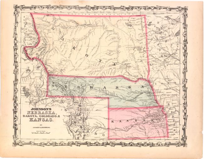
This colorful map features Nebraska with a long panhandle to about present-day Idaho near Ft. Bridger and Fremont's Peak. Above Nebraska is a huge Dakota Territory that extends all the way to the Canadian border, west to the Continental Divide and east to Minnesota Territory. The map is filled with information and locates numerous Indian tribes, trading posts, wagon roads and trails, exploration routes, mountain peaks, and more. It shows the railroad routes explored by Gov. Stephens, Lt. Beckwith, and Capt. Gunnision, numerous forts and early settlements. The Oregon Trail is shown, but not named, and several other emigrant roads are traced including several converging on Denver. North, Middle, and South Parks, as well as several forts and a few towns are shown in Colorado.
References:
Condition: B+
Original color with a few faint spots and light toning in blank margins.