Subject: North America
Period: 1846 (dated)
Publication: Universal Atlas
Color: Hand Color
Size:
13 x 15.5 inches
33 x 39.4 cm
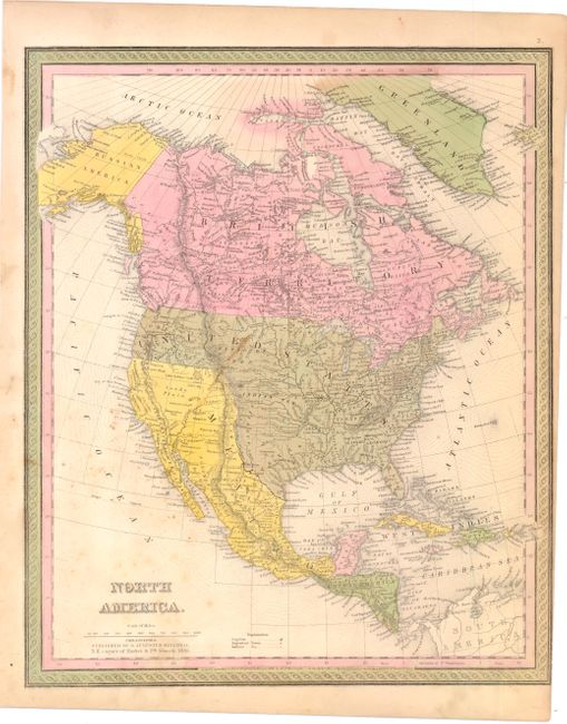
Terrific map that shows the region just prior to the Mexican/American War and just after settlement of the Oregon boundary dispute. Mexico controls California and the southwest, Texas appears in the large configuration bounded by the Rio Grande and Arkansas rivers, and Alaska is Russian America. All of Canada is labeled British Territories. Filled with information including forts, Indian tribes and scores of place names. This example was registered by H.N. Burroughs in 1846, with Mitchell's imprint below the title and also dated 1846.
References:
Condition: B
Nice color and impression. There is some staining and light scattered foxing in the image and the right side margin has been trimmed to the neatline at bottom.