Subject: Exploration and Surveys
Period: 1845 (published)
Publication:
Color: Black & White
Size:
7 x 10 inches
17.8 x 25.4 cm
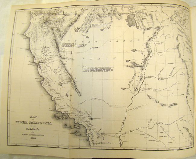
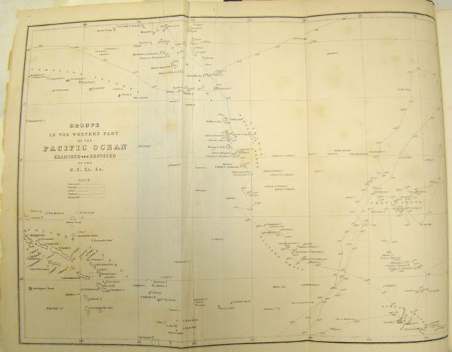
This was one of the most important American scientific expedition of the 19th century. It was the first U.S. Naval expedition, taking in the Northwest Coast, Hawaii, South America, the Philippines, the South Pacific, Australia and Antarctica. The expedition broke new ground in most areas of natural history, made a number of extremely important cartographic discoveries, most importantly establishing that Antarctica was a continent. They mapped 280 islands in the Pacific for the first time and included extensive and graphically rich ethnographic records of many native peoples throughout the Pacific.
This volume includes the "Map of Upper California by the U.S. Ex. Ex. And Best Authorities, 1841" (11.2 x 8.2"). It extends east to the Rocky Mountains, showing fair knowledge of California, but only a basic understanding of the Great Basin area east of California from Nevada to Utah, Colorado, and New Mexico. The most famous aspect of the map is the identification of Smith's Track across what is present-day Nevada, a reference to the notable mountain man Jedidiah Smith. The report also contains three other folding maps of the Pacific islands and of the world showing ocean currents related to whaling. Octavo, 558 pp. hardbound in original embossed brown cloth covers with gilt cover and spine.
References:
Condition: B+
Pages show some light toning and staining. There is a library stamp on the title page and front pastedown. All maps are very good, with only the Pacific Island map having a fold separation repaired with archival tape on verso. Covers some light wear with the edges bumped, and the spine is chipped at bottom.