Subject: North Pacific Ocean
Period: 1771 (dated)
Publication:
Color: Hand Color
Size:
24.5 x 18 inches
62.2 x 45.7 cm
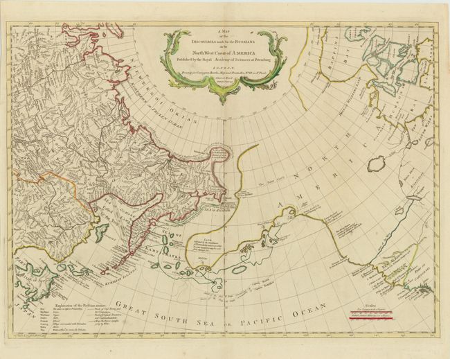
This map is a reissue of Thomas Jefferys' map from 1761. It is based on Gerhard Mueller's map of 1758, which was one of the first to correctly depict the Kurile Islands and also suggest the outline of Alaska and the Aleutian chain. It shows great detail of the Arctic coast of Siberia based on Vitus Bering's second Kamchatka expedition from 1733-43, and illustrates the sea routes made by Captains Bering and Chirikof. In the largely unexplored North America, the River of the West is boldly shown extending to Lake Winipigon. The discoveries of several different explorers are shown along the coast, including those of Bering, Tschirikow, and Sir Francis Drake. The map includes a decorative title cartouche.
References: cf. Wagner (NW) #597; Falk #1771-2.
Condition: A
Heavy, watermarked paper with faint toning along centerfold at top and a short centerfold separation at bottom, far from map image.