Catalog Archive
Auction 137, Lot 828

"Carte Reduite de l'Ocean Orientale qui Contient la Cote d'Afrique… Avec l'Isle Madagascar et les Isles adjacentes", Apres de Mannevillette, Jean B. N. D.

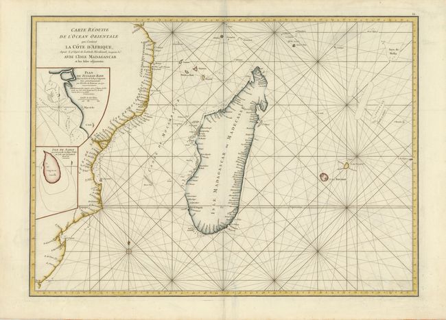
Subject: Southern Africa and Madagascar

Period: 1775 (circa)

Publication: La Neptune Oriental…

Color: Hand Color

Size:
26.3 x 19 inches
66.8 x 48.3 cm
Download High Resolution Image
(or just click on image to launch the Zoom viewer)

A French sailor and hydrographer, D' Après de Mannevillette (1707-1780) used new instruments to correct the latitudes measured by previous explorers. His atlas Le Neptune Oriental, first published in 1745, was considered a major achievement and an indispensable resource for navigators. This uncommon sea chart covers the coast from Natal to Quiloa, Madagascar and the nearby islands. Insets of "Plan de Tullear-Baye" and "Isle de Sable…" are included. The handsome chart provides detailed navigational information.

References:

Condition: B

Repaired crease/tear at bottom, right of centerfold and a few faint spots.

Estimate: $475 - $550

Sold for: $350

Closed on 9/14/2011

Archived