Subject: Egypt
Period: 1851 (circa)
Publication:
Color: Hand Color
Size:
29.3 x 21.3 inches
74.4 x 54.1 cm
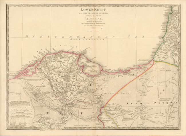
Beautifully engraved map covering the region from Arabs Bay (Plinthinetes Sinus) in the west to the delta of the Nile and into the Holy Land to above Mt. Carmel, and south to well below Memphis to Atsieh, Adhroditopolis, and Ellahoun. Fine detail throughout, with scores of villages located and named, numerous roads, trails and camel routes detailed and many named, for example "Derb el Fern - Upper Road belonging to the Haouatat Bedwins." Fully and very finely engraved in the deserts to simulate sand. Delineates the Lake of Menzaleh near the mouth of the Nile. Seven distance scales and a table gives the translation for some common Arabic names. Wyld assumed management of Faden's establishment in 1823, and this map is a reissue of Faden's map of 1802, updated with proposed railways. Delarochette, who also worked with Faden, is responsible for the remarkable engraving. This map is circa 1851given its mention to the "Model of the Earth" in Wyld's imprint, which is the year he exhibited the Monster Globe in Leicester Square as part of the Great Exhibition of London in 1851.
References:
Condition: B+
Map is in very good condition with some very minor creasing in the lower portion of the paper primarily in the blank margin. There are a few small spots and faint centerfold toning.