Catalog Archive
Auction 137, Lot 741
"Carte des Isles du Japon et la Presqu Isle de Coree, avec les Costes de la Chine Depuis Pekin Jusqu'a Canton", Bellin, Jacques Nicolas
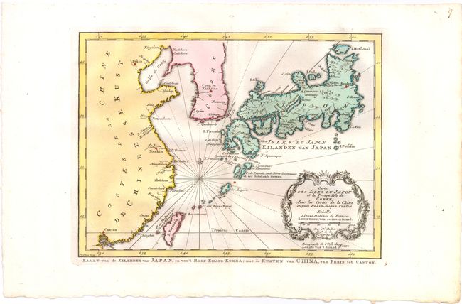
Subject: China, Korea & Japan
Period: 1773 (published)
Publication: Raynal's Atlas Portatiff…
Color: Hand Color
Size:
11.3 x 8.3 inches
28.7 x 21.1 cm
Download High Resolution Image
(or just click on image to launch the Zoom viewer)
(or just click on image to launch the Zoom viewer)