Catalog Archive
Auction 137, Lot 661

"Carte Reduite de la Mer Mediterranee", Bellin, Jacques Nicolas

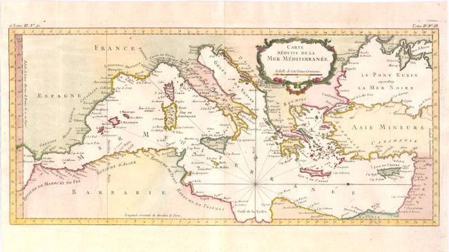
Subject: Mediterranean

Period: 1764 (circa)

Publication:

Color: Hand Color

Size:
19.5 x 9 inches
49.5 x 22.9 cm
Download High Resolution Image
(or just click on image to launch the Zoom viewer)

This lovely map of the Mediterranean stretches from the Strait of Gibraltar in the west to the coast of Syria in the east, and includes the majority of the Black Sea. The map focuses on the islands in the Mediterranean and names coastal towns without much inland detail, with the exception of the Appenini mountain range in Italy. One set of rhumb lines radiates from the southern portion of the sea, with a simple fleur de lys pointing north. The map also features a decorative, floral title cartouche.

References:

Condition: A+

Issued folding, now pressed, on watermarked paper.

Estimate: $220 - $300

Sold for: $300

Closed on 9/14/2011

Archived