Subject: North Pole
Period: 1643 (published)
Publication: Tresor des Cartes Geographiques
Color: Black & White
Size:
7.5 x 5.5 inches
19.1 x 14 cm
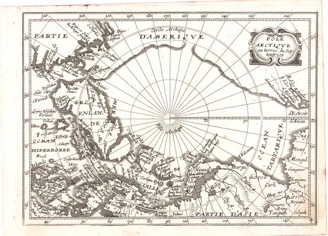
This map of the North Pole is based on Jansson's Septentrionalium Terrarum Descript from the Atlas Minor, published in 1628, which incorporated the discoveries of the recent voyages that attempted to locate a northern route to Asia. In North America, at top left, Hudson Bay has been omitted. Fictitious islands appear in the North Atlantic, including Frislande, and a simplistic Strait of Anian is depicted at right. Boisseau’s rare Tresor des Cartes, the first true French world atlas, was created for the eight-year-old future King Louis XIV.
References: Burden (NA) #263; Kershaw, K.A. #114.
Condition: B+
Minor soiling in bottom-right corner. Two small binding holes in left blank margin.