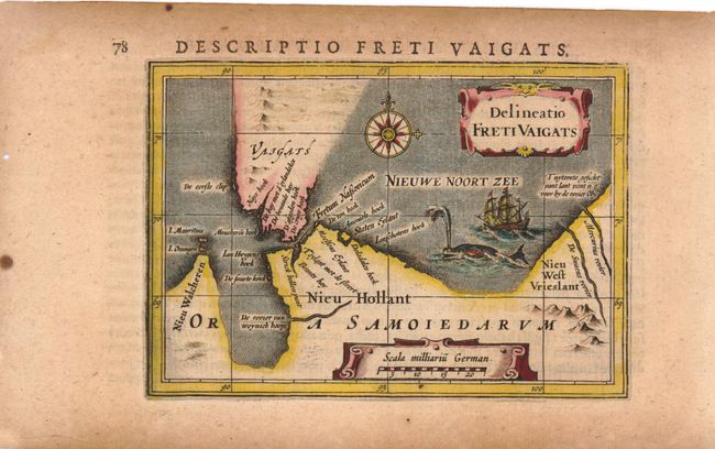
Subject: Vaygach Island, Russia
Period: 1618 (circa)
Publication: Tabularum Geographicarum
Color: Hand Color
Size:
5 x 3 inches
12.7 x 7.6 cm
This miniature map shows the straits between mainland Russia and Vaygach Island, an area that was discovered by western Europeans during their search for a northern passage to Asia. The first visit was by Hugh Willoughby in 1553. Then in 1596, Willem Barents rounded the north point of Novaya Zemlya, and wintered on the east coast near the northern tip. At the time Vaygach Island was thought to be a part of Novaya Zemlya. The map is decorated with a sailing ship, compass rose, spouting whale, and a nice title cartouche.
References: King (2nd ed.) pp. 80-82.
Condition: B+
Toned, with a few small wormholes in blank margins, far from map image.