Subject: Paris, France
Period: 1744 (dated)
Publication:
Color: Hand Color
Size:
35 x 23.5 inches
88.9 x 59.7 cm
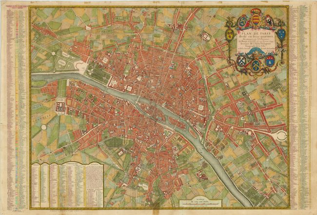
This large, striking bird's-eye plan of Paris is divided into the sixteen districts that were established in 1684. The title cartouche is surrounded by coats of arms of the members of the Bureau de la Ville (city government) and Jean-Baptiste Taitbout, the clerk of the court. Tables along both sides and at bottom indicate the locations of roads, churches, schools and hospitals. The map is beautifully detailed with depictions of gardens, windmills, fields, and boats along the river Seine.
References:
Condition: B+
Issued folding. There are a few stains from cello tape that was previously removed in the margins, two of which enter map border 1-2" at bottom. Several short tears have been closed on verso with old paper and archival tape; two of the tears enter 0.5-1.5" into the map image.