Subject: France
Period: 1617 (dated)
Publication: Théâtre géographique du Royaume de France
Color: Hand Color
Size:
18.2 x 14.1 inches
46.2 x 35.8 cm
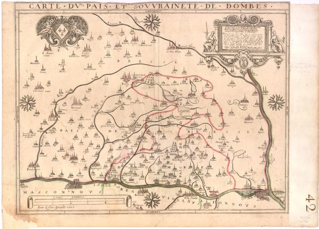
This uncommon map, oriented with east at the top, depicts the district of Dombes in the southeast of France, bounded by the Saone River in the west and the Rhone River in the southeast. The extensive system of rivers is highlighted, and the towns are depicted with charming bird's eye plans, including Lyon, Macon, and Bourg-en-Bresse. In the upper-right corner is a dedication cartouche to the princess of Dombes, Marie de Bourbon, by the engraver, Mathias Mareschal. At top left is the coat of arms of Dombes supported by putti.
References:
Condition: B
There are two faint damp stains and light creasing at top. The right-hand side has been remargined to neatline, and the bottom left corner has been replaced with old paper.