Subject: Belgium
Period: 1793 (dated)
Publication:
Color: Hand Color
Size:
17.6 x 14.4 inches
44.7 x 36.6 cm
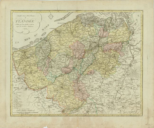
This map of western Belgium depicts the country during the Liege Revolution (1789-95), in which the central region of Flanders changed occupation several times between the Austrians and the French. Depicted along the eastern edge of the map is the Duchy of Brabant, which was dissolved in 1795 during the French occupation. Large towns are depicted with bird's-eye views, and a legend at bottom left identifies towns of various sizes, post offices, abbeys, roads, and even battle grounds. The map is adorned with a simple compass rose.
References:
Condition: B+
There are a few faint spots and a damp stain in bottom margin that just enters map border, and a few faint printer's creases at bottom. There are a few short tears and a small chip in bottom blank margin, far from map image.