Subject: Wales
Period: 1644 (circa)
Publication:
Color: Hand Color
Size:
19.7 x 15 inches
50 x 38.1 cm
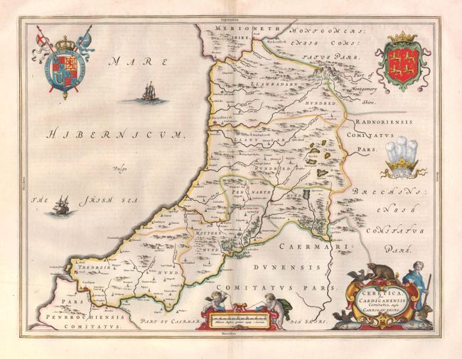
This lovely, decorative map of the Welsh county of Cardiganshire (now known as Ceredigion) identifies villages, settlements, rivers, lakes, mountains and woods. The Royal Coat of Arms within the Garter is featured at left, with the Coat of Arms of Wales and the Prince of Wales' Feathers at right. The map features a title cartouche surrounded by birds, fish, beavers, and a hunter, as well as a scale of miles cartouche with putti using a surveyor's chain. The map is adorned with two ships and a compass rose in the Irish Sea. French text on verso.
References:
Condition: B+
Wide margins and nice color with a centerfold separation at top that just enters neatline, closed on verso with archival materials. Also a small, faint stain near upper centerfold.