Subject: England
Period: 1675 (circa)
Publication: Britannia
Color: Hand Color
Size:
17.3 x 13.8 inches
43.9 x 35.1 cm
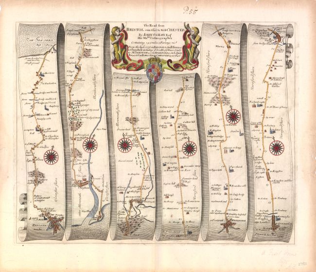
John Ogilby's 'Britannia' was published between 1675 and 1698. It is a landmark in the mapping of England and Wales. Its unique format constituted the first national road-atlas of any country in Western Europe. It was composed of maps of seventy-three major roads and cross-roads, presented in a continuous strip-form, on a uniform scale of one inch to a mile. Each beautiful map includes wonderful detail of the countryside with each strip containing a large compass rose to indicate changes in direction.
Attractive strip-style map covering the road from Bristol to Ludlow in six strips totaling 76 miles. Each of the six panels has a decorative compass rose to orient the traveler. The title cartouche is flanked by putti with sheaves of wheat, representing the rich agricultural region, and the royal coat of arms.
References:
Condition: B+
Very nice color. Edges of margin are chipped and slightly toned with a tiny hole in the bottom portion of image just to the right of centerfold.