Subject: Atlantic Ocean
Period: 1745 (circa)
Publication: Atlas der Zeevaart
Color: Hand Color
Size:
22 x 19 inches
55.9 x 48.3 cm
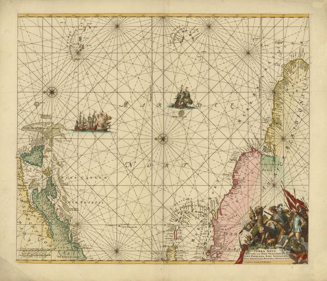
This magnificent sea chart of the western Atlantic shows the coastlines of North America from Cape Charles, Maryland to Newfoundland, and the West Indies to the northern coast of Brazil. Oriented by two compass roses with north to the left; the Azores and Cape Verde Islands are at the top of the map. The map was originally produced by Frederick de Wit in circa 1675, which was in turn derived from that of Theunis Jacobsz in circa 1650. It was etched by the renowned Dutch engraver Romeyn de Hooghe. The map has been updated with a few more place names in North America including Mariland, B. de Delware and Penselvanie (which appears south of Mariland). One of the cartouches has been eliminated to reveal the location of Bermuda. The Groot Bank van Terra Neuve (fishing banks) has been expanded and a Mael Stroom now appears in the Atlantic. The Dutch title cartouche remains with figures of explorers and natives clustered around a llama. In the sea are sailing ships, including a raging sea battle, rhumb lines and compass roses.
References: Burden #467.
Condition: A
A sharp impression and nice color with a few faint spots.